, and markings for Huskisson's tomb and the lodge (unlabelled). The mount includes marked shapes for the houses on the northern (top) part, as well as another unlabelled building in the centre. St James' Road is to the west (left), Sandon Terrace is to the north (top), Hope Street is to the east (right), and Upper Parliament Street is to the south (bottom).")
)
)
)
)
)
)
)
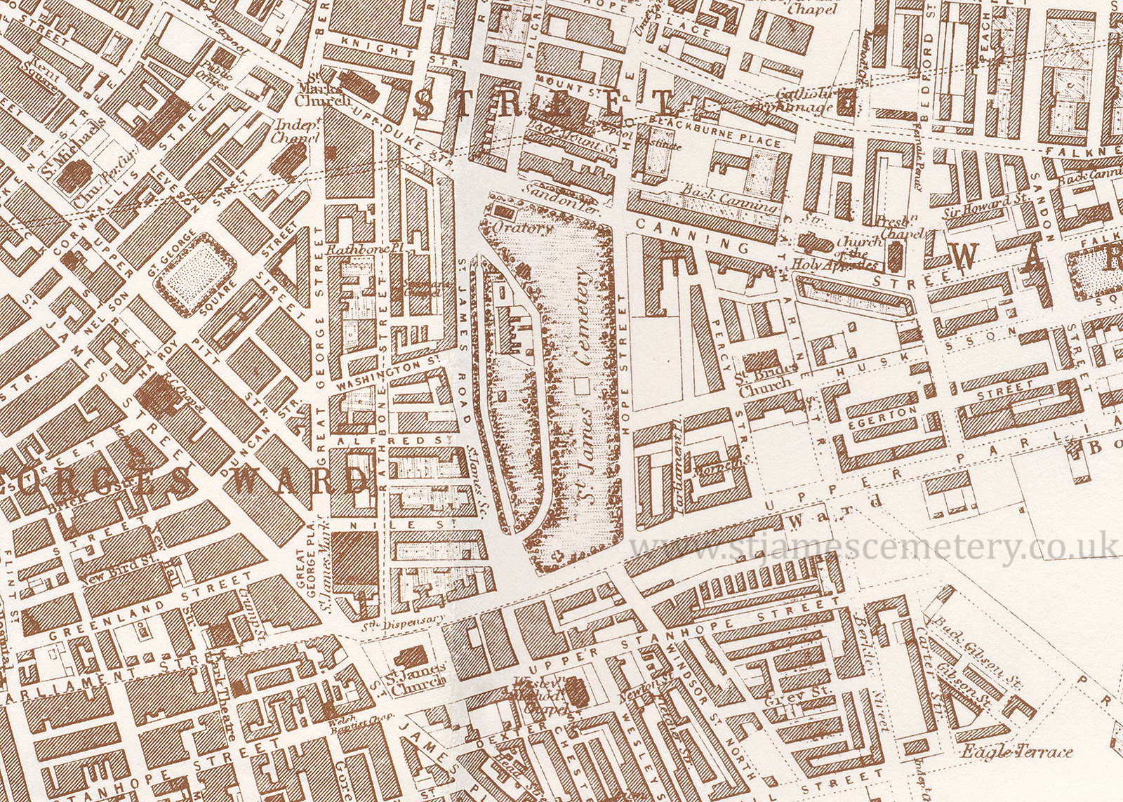
1855 Map
This map from 1855 by B. R. Davies shows the area much more built up than maps from the early 19th century. The cemetery shows the oratory (labelled), and markings for Huskisson's tomb and the lodge (unlabelled). The mount includes marked shapes for the houses on the northern (top) part, as well as another unlabelled building in the centre. St James' Road is to the west (left), Sandon Terrace is to the north (top), Hope Street is to the east (right), and Upper Parliament Street is to the south (bottom).